

At Shashikiran Surveyors, we provide accurate and reliable land surveying services to support construction, infrastructure, and land development projects. Using advanced equipment and proven techniques, our team ensures precise measurements, clear boundary identification, and detailed mapping for every site. We focus on delivering dependable data that helps clients make informed decisions, avoid disputes, and execute projects smoothly from start to finish.
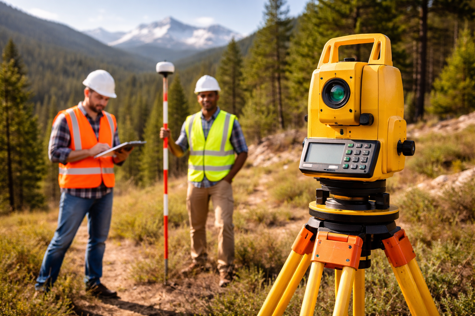
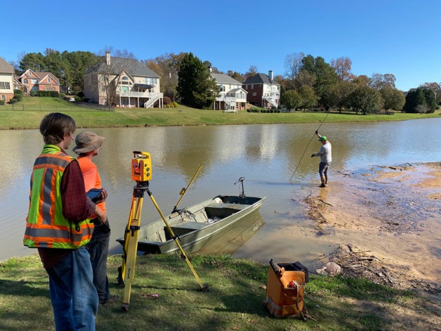
At Shashikiran Surveyors, we offer precise and efficient total station surveying services for a wide range of construction and infrastructure projects. A total station is an advanced electronic instrument that combines distance measurement and angle calculation to deliver highly accurate data. Our skilled team uses modern total station equipment to ensure exact positioning, alignment, and mapping, making it ideal for building construction, road works, layout marking, and land development.

At Shashikiran Surveyors, we provide highly accurate DGPS (Differential Global Positioning System) surveying services for projects that require precise positioning and geospatial data. DGPS technology enhances standard GPS accuracy by correcting signal errors, allowing us to deliver exact coordinates and reliable measurements. Our DGPS surveys are widely used in land mapping, infrastructure planning, road projects, and large-scale developments where accuracy is critical.
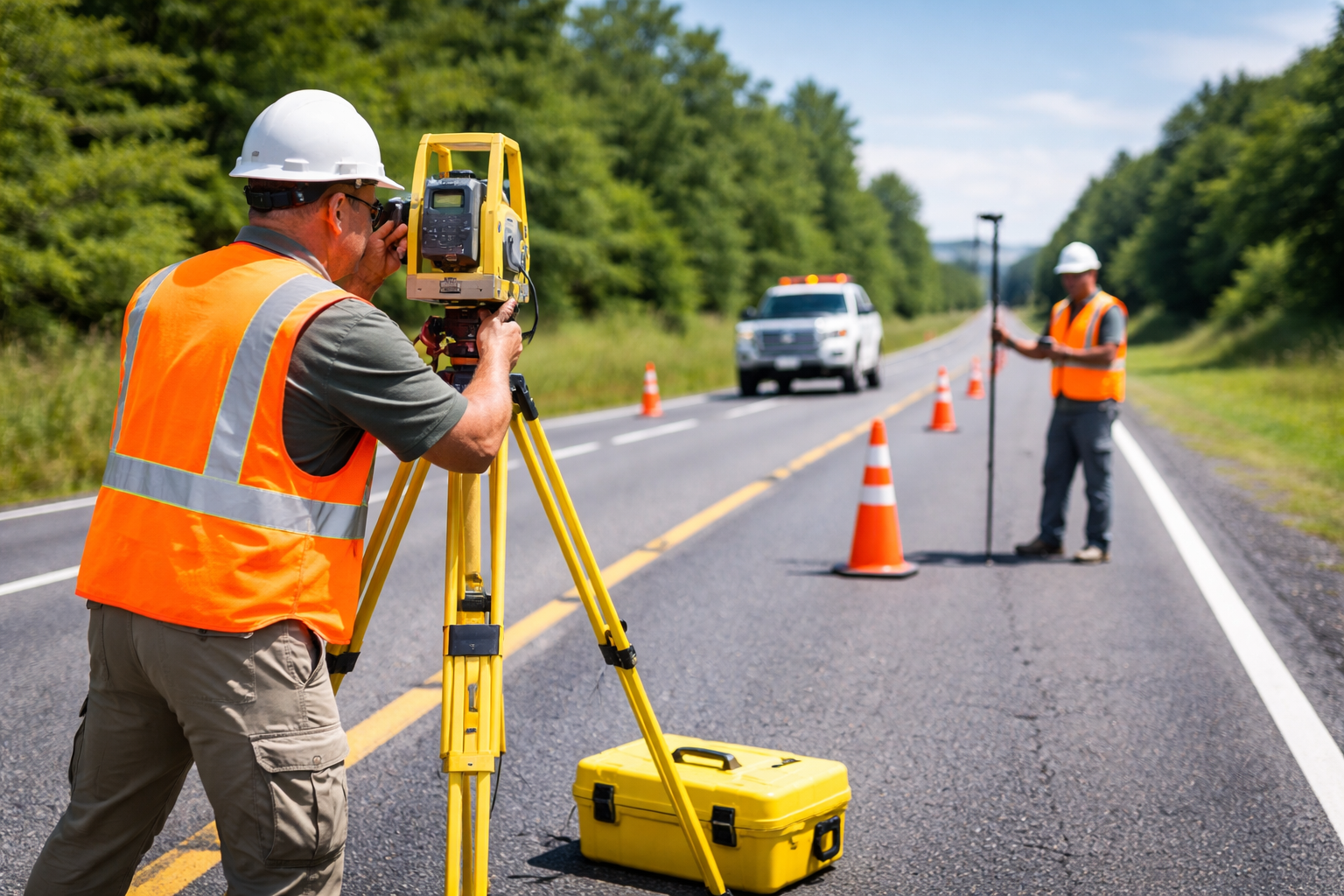
At Shashikiran Surveyors, we provide accurate and reliable road surveying services essential for planning, designing, and executing road and highway projects. Our expert team uses advanced equipment such as Total Station, DGPS, and GPS to capture precise data on alignment, elevation, and terrain conditions. We ensure every road project is supported with detailed measurements and mapping, helping engineers and contractors achieve smooth and efficient project execution.
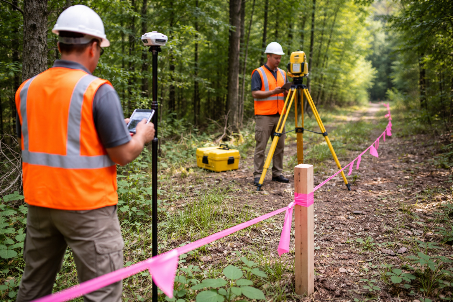
At Shashikiran Surveyors, we provide precise and reliable boundary surveying services to clearly define property limits and avoid disputes. Our experienced team uses advanced equipment like Total Station, DGPS, and GPS to accurately measure and mark land boundaries as per legal records. We ensure that every boundary survey is conducted with high accuracy and proper documentation, helping landowners, developers, and builders proceed with confidence.
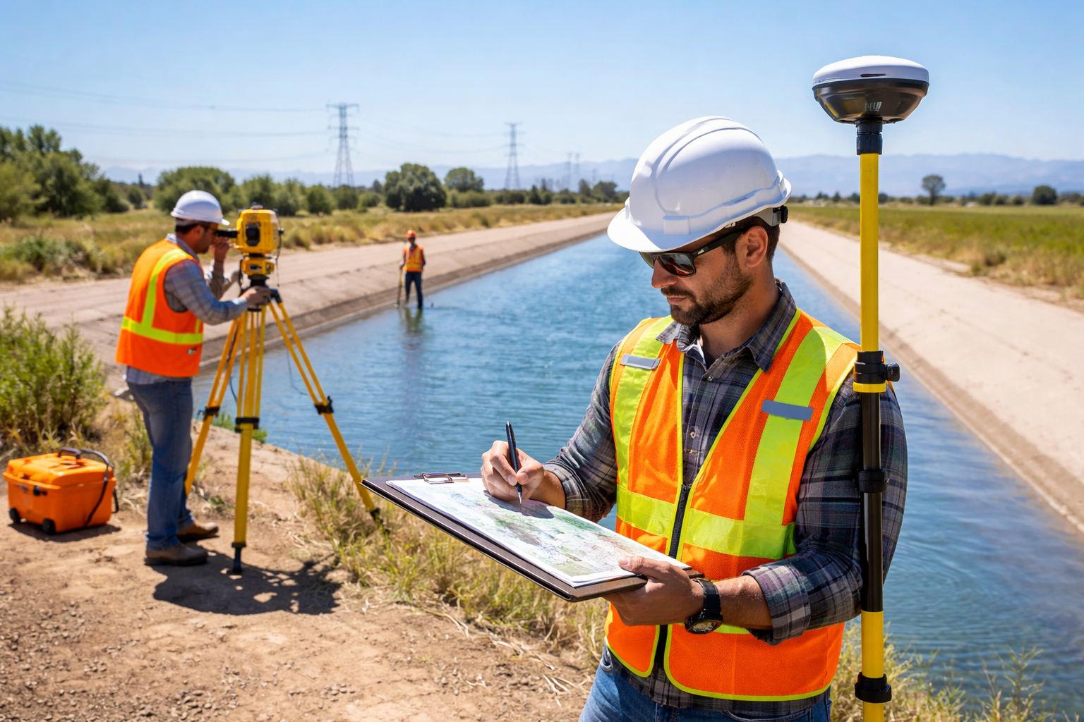
At Shashikiran Surveyors, we offer accurate and reliable canal surveying services to support irrigation planning, construction, and maintenance projects. Our team uses advanced equipment such as Total Station, DGPS, and GPS to measure alignment, levels, and terrain conditions with high precision. We ensure proper data collection for efficient canal design, water flow management, and long-term sustainability of irrigation systems.
At Shashikiran Surveyors, we provide accurate and reliable tank surveying services to support water resource management, irrigation planning, and maintenance projects. Our team uses advanced equipment such as Total Station, DGPS, and GPS to measure tank boundaries, storage capacity, and surrounding terrain with high precision. We ensure detailed data collection to help in effective planning, desilting, and long-term sustainability of water bodies.
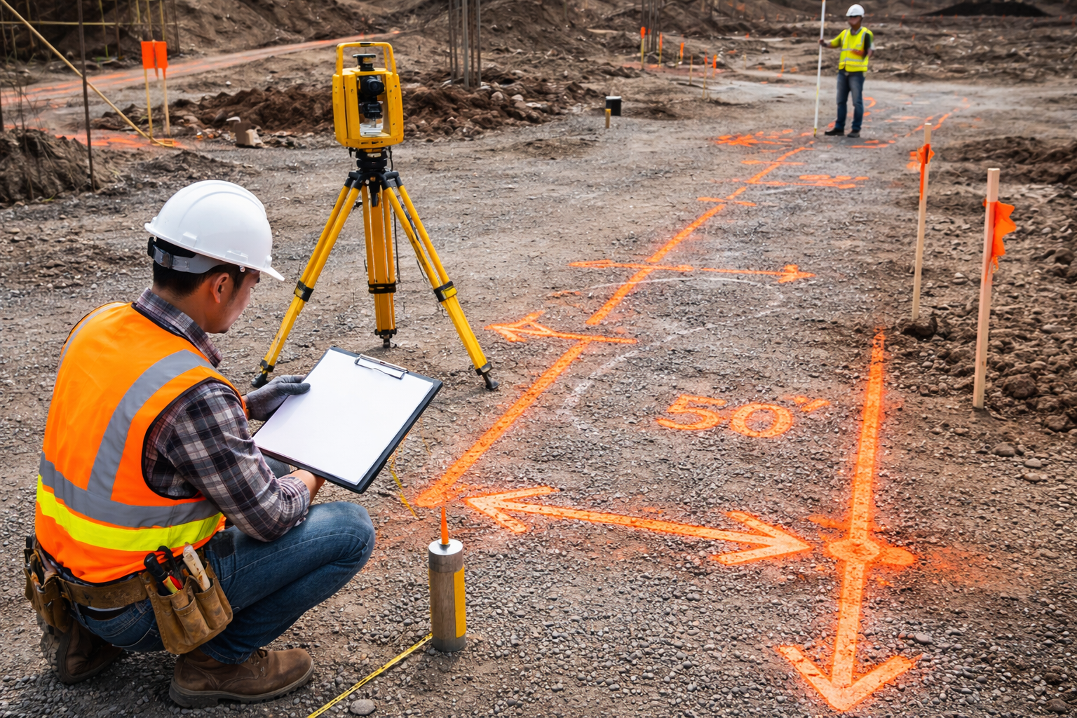
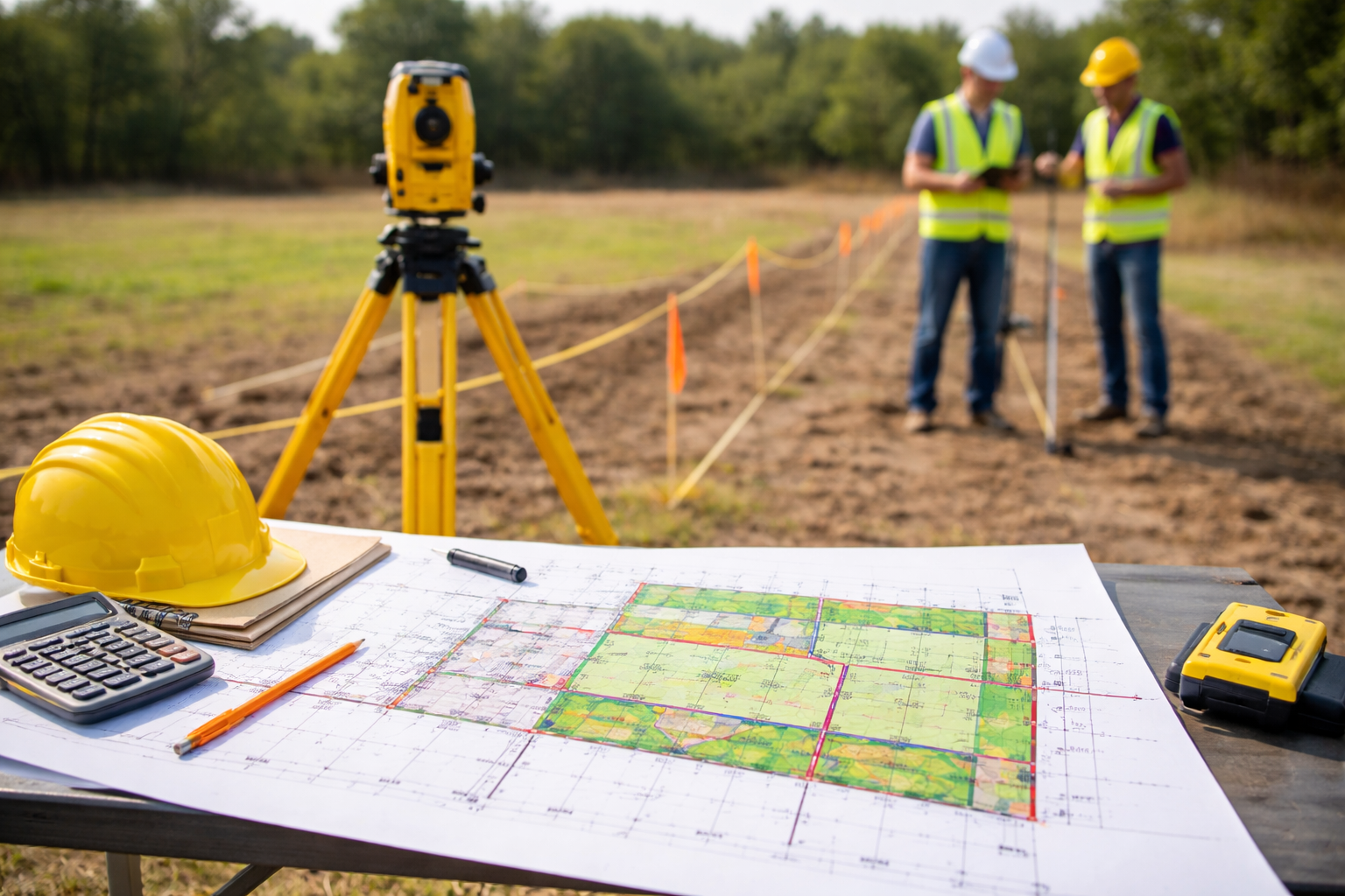
At Shashikiran Surveyors, we provide precise layout surveying and marking services to ensure accurate execution of construction and development projects. Our team uses advanced instruments like Total Station and DGPS to transfer design plans onto the ground with exact measurements. From residential layouts to large-scale infrastructure projects, we ensure proper positioning, alignment, and spacing as per approved drawings, helping avoid costly errors during construction.
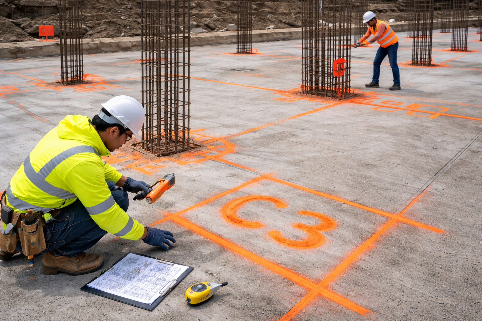
At Shashikiran Surveyors, we provide precise building marking and column marking services to ensure accurate execution of construction projects. Using advanced instruments like Total Station and DGPS, our team transfers architectural and structural drawings onto the site with exact measurements. We ensure proper positioning of foundations, columns, and structural elements, helping builders achieve perfect alignment and avoid costly construction errors.

At Shashikiran Surveyors, we provide accurate and reliable irrigation surveying services to support efficient water management and agricultural development. Our team uses advanced equipment like Total Station, DGPS, and GPS to assess land levels, slopes, and water flow patterns with high precision. We help design and plan irrigation systems that ensure proper water distribution, improved crop productivity, and sustainable resource utilization.

At Shashikiran Surveyors, we provide accurate and efficient GPS surveying services for a wide range of land and infrastructure projects. Using advanced Global Positioning System technology, our team captures precise location data and coordinates for mapping, planning, and development purposes. GPS surveying is ideal for large areas and ensures reliable results with quick data collection, making it a cost-effective solution for modern surveying needs.

At Shashikiran Surveyors, we provide detailed and accurate topographic surveying services to map the natural and man-made features of a land area. Our team uses advanced equipment like Total Station, DGPS, and GPS to capture elevations, contours, and surface details with high precision. These surveys are essential for planning, design, and development in construction, infrastructure, and land development projects, ensuring a clear understanding of the terrain before execution.
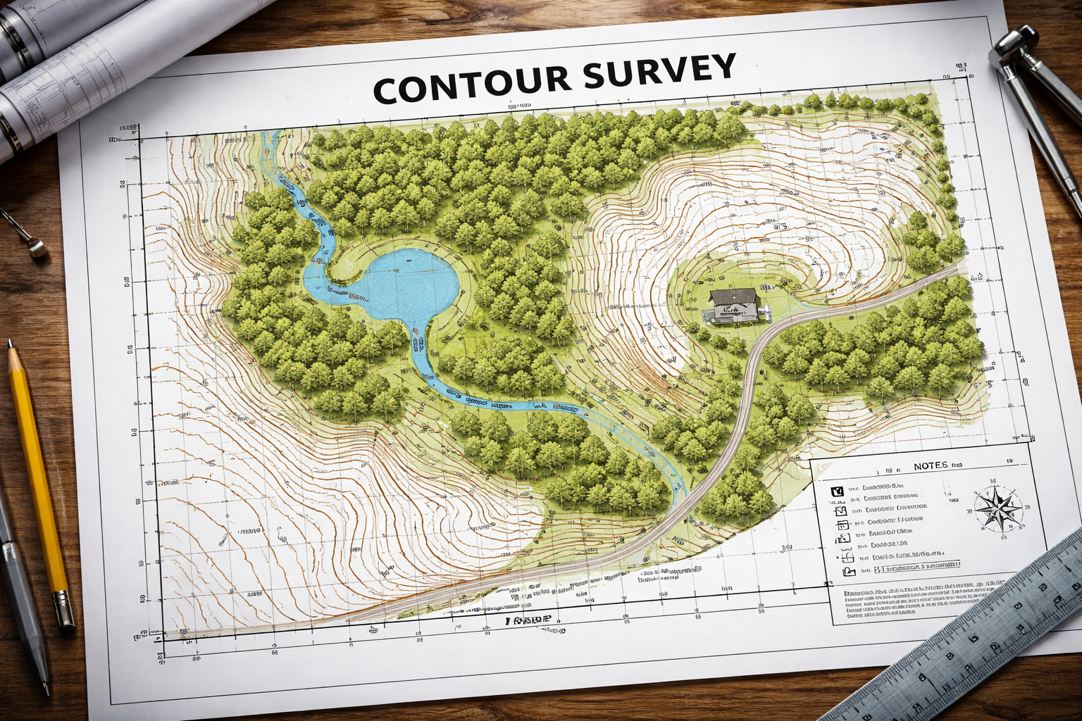
At Shashikiran Surveyors, we provide accurate contour surveying services to determine the elevation and shape of the land surface. Our team uses advanced equipment like Total Station, DGPS, and GPS to map contour lines that represent ground levels and slopes. These surveys are essential for construction planning, land development, irrigation projects, and infrastructure design, helping clients understand terrain variations and plan effectively.

At Shashikiran Surveyors, we provide accurate and reliable industrial surveying services to support the planning, design, and execution of industrial projects. Our team uses advanced equipment such as Total Station, DGPS, and GPS to deliver precise measurements for factories, plants, warehouses, and large-scale industrial developments. We ensure proper alignment, positioning, and mapping to help industries achieve efficient layouts and smooth project execution.

At Shashikiran Surveyors, we provide advanced GIS (Geographic Information System) surveying services to collect, analyze, and manage spatial data for better planning and decision-making. Our team integrates field survey data with GIS technology to create accurate maps and detailed geospatial insights. These services are widely used in urban planning, infrastructure development, land management, and environmental studies, helping clients visualize and analyze data effectively.
At Shashikiran Surveyors, we provide accurate and reliable land plotting surveying services to help divide land into well-defined plots for residential, commercial, and industrial developments. Using advanced equipment like Total Station, DGPS, and GPS, our team ensures precise measurements, proper alignment, and clear demarcation of plots as per approved layouts. We help developers and landowners achieve organized land division with complete accuracy and compliance.

At Shashikiran Surveyors, we provide precise and reliable mining surveying services to support exploration, planning, and extraction activities. Our team uses advanced equipment like Total Station, DGPS, GPS, and drone technology to capture accurate data of mine sites, including surface and subsurface details. We help ensure safe, efficient, and well-planned mining operations by delivering detailed measurements and mapping for better decision-making.

At Shashikiran Surveyors, we offer advanced digital land surveying services that combine modern technology with precise measurement techniques to deliver highly accurate and reliable results. Using tools like Total Station, DGPS, GPS, and specialized software, we capture and process land data digitally, ensuring detailed mapping and efficient project execution. Our digital approach minimizes errors, enhances data accuracy, and provides clear insights for planning, design, and development.